OK - so this is not exactly new news.
Google picked up the technology from Keyhole, which has been around, in one form or another, since 2001.
And a somewhat more scientifcally oriented application (as opposed to consumer/commercial) has been available for a couple years - NASA's WorldWind.
WorldWind also renders USGS data, so it actually offers more detail in more remote places - I tracked a winding road up a deserted mountain in WV from a couple hundred feet above ground.
Google Earth (at present) cannot produce that level of detail in remote locations - replicating the same view on the same desterted mountain in WV, the image loses any functional clarity at maybe 5000 feet above ground.
However, who cares about deserted mountains in WV? Well, I do, but that's not representative of anything.
WorldWind is phenomenal - it has a powerful 3D engine, and uses hybrid imagery captured from various satellites to present a breathtaking view of the earth from any angle.
Google, on the other hand, is brining it to the CONSUMER, and that's what makes their application so powerful (aside from the fact that Google's penetration is exponentially greater - tens of millions use Google every day, and only a tiny little portion of the masses have ever visited NASA's site).
What Google Earth has done is take Keyhole's awesome utilization of technology, improved the interface, and merged geographical data with search to provide a map of the world, complete with everything from ATMs, to restaurants, nightclubs, golf courses and grocery stores all superimposed in layers on top of the map (all based on your selections, of course). Additionally the Google Earth Community posts information snippets about a great expanse of important and notable locations.
Finally, for major metropolitan areas, they've created 3D computer-generated representations of buildings, true to shape and scale. They also have done such a job replicating depth and height - you can actually cruise through the Grand Canyon, surrounded on both sides by rock walls.
And seriously, this is just the tip of the iceberg - there is so much more to explore: crime stats, census information, earthquakes and volcanoes, and on and on.
Here's a couple screenshots to whet your appetite:
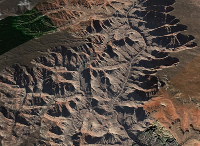
The great Grand Canyon from about 12 miles up.
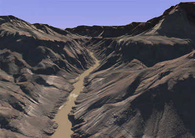
And from just above the Colorado River, surrounded by the walls of the Grand Canyon.
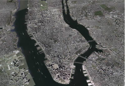
Manhattan Island, New York City, from over 17K feet.
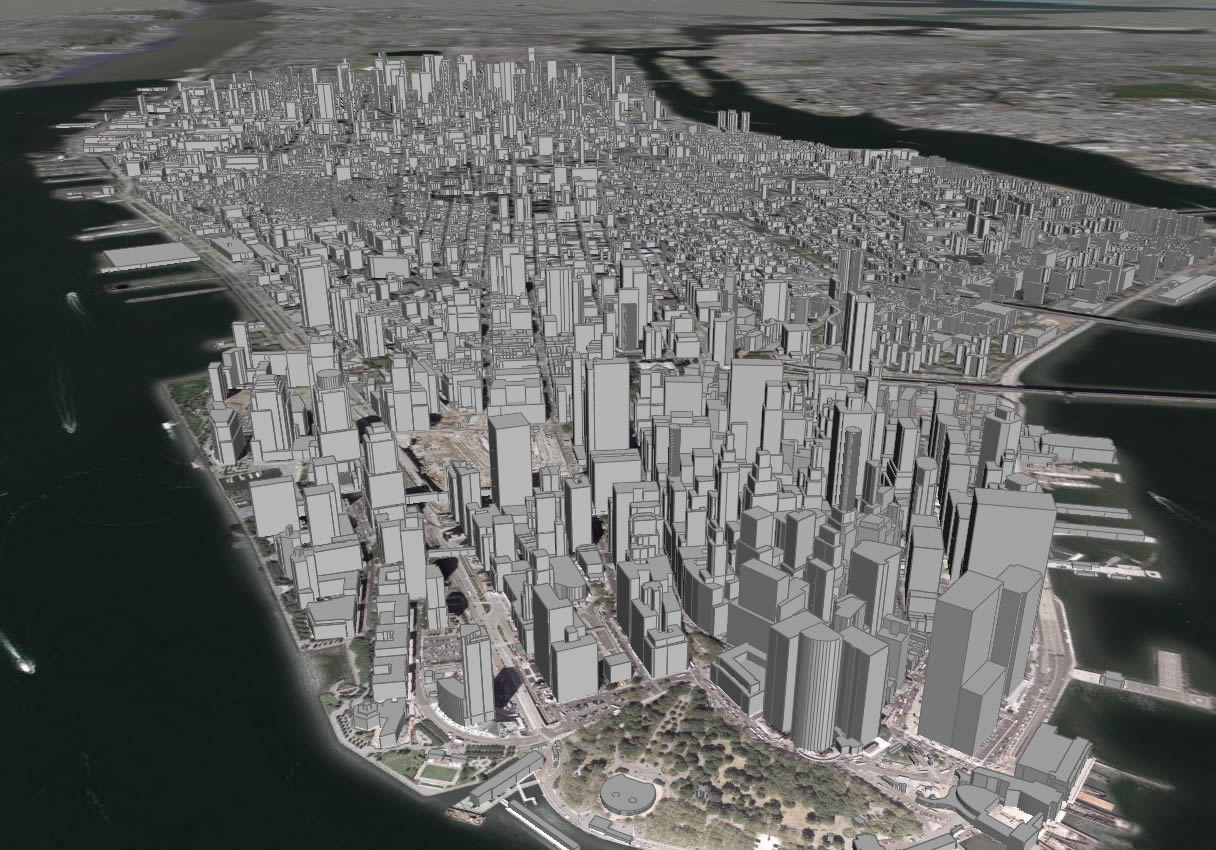
Up a bit closer on Manhattan, with Google's 3D Buildings enabled.
Get it, get it installed. Take the tour. If you've never seen anything like it before, you are in for a somewhat amazing experience. Visit the Eiffel Tower in Paris and the Red Square in Moscow and the Google Campus in California all in a matter of moments. If you live in a city - it's likely you'll be able to zoom into your bedroom window. From space. Oh, and you need to find the nearest gas station, and you need directions? That's just a click away.
No comments:
Post a Comment